Mobility Intelligence Software for Legged Robots
Overview
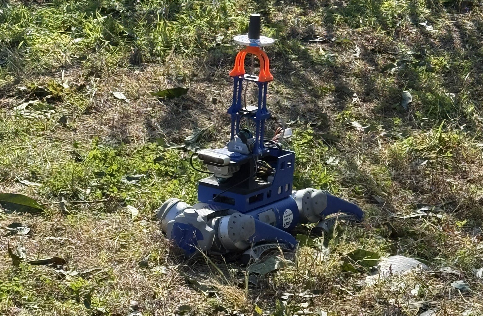
- A five-year national project: software that lets quadruped robots move on their own through unstructured sites.
- Tested at a disaster-response course, a substation, and an orchard; phase 2 extends it to a two-robot team.
- Phase 1 met all eight targets and passed a certified third-party test; phase 2 met its three error targets.
Platform
Unitree Go1 and Go2
Sensors
Two Livox Mid-360, camera, IMU
Environment
Disaster course, substation, orchard
Sensorstwo LiDARs, camera, IMU
Odometry and localization
Static map and terrain
Navigation and control
Mission and teleoperation
Highlighted: my part.
My Part
Two-LiDAR sensor system
Replaced one Ouster OS0-128 with two Livox Mid-360s, calibrated them, and moved the stack to ROS 2.
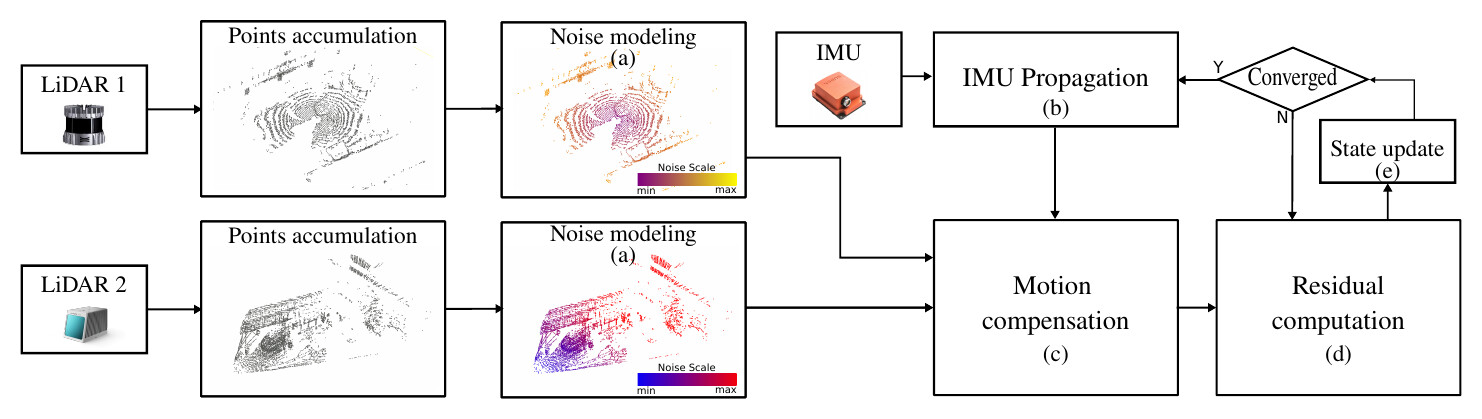
NM-LIO (RiTA 2024)
Multi-LiDAR odometry that models each LiDAR’s noise, so the second LiDAR adds coverage, not error.
13.45 cm relative error after a 1 km course
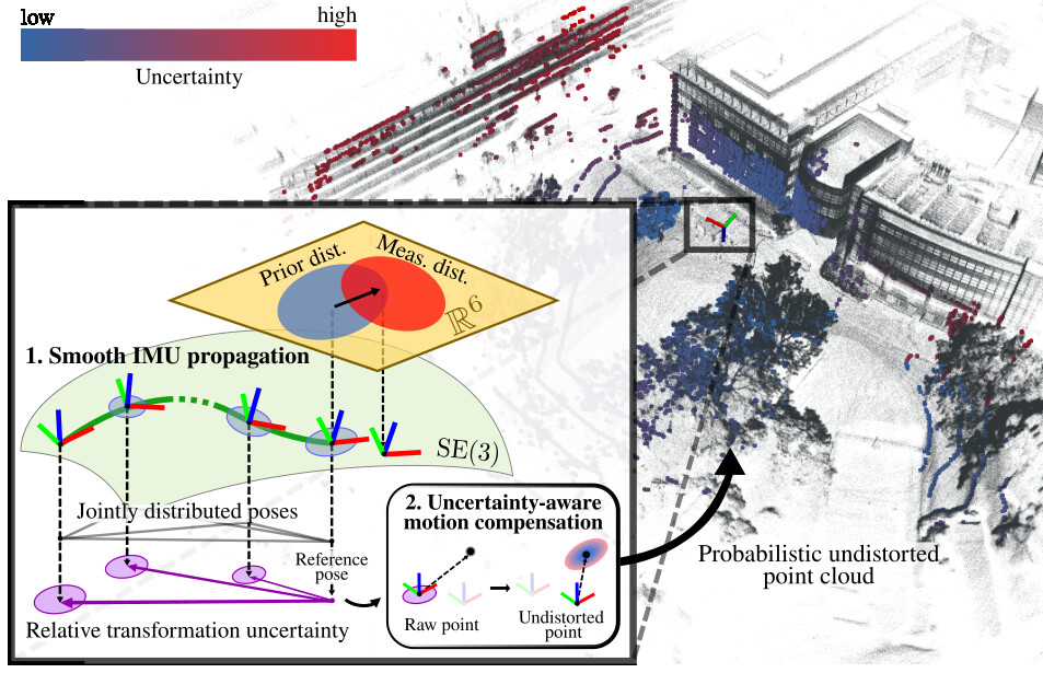
SE(3)-LIO (ICRA 2026)
Odometry that stays smooth through the shaking of a walking robot; runs on both phase-2 robots.
Orchard 1 km: RPE 10.0 cm (target 12 cm)
Map-based localization
Offline map building plus online localization in the map; two robots on one shared map in phase 2.
13.15 cm relative error on the 1 km course