CVGL-SLAM: Satellite Imagery as an Absolute Constraint for Drift-Bounded SLAM
Abstract
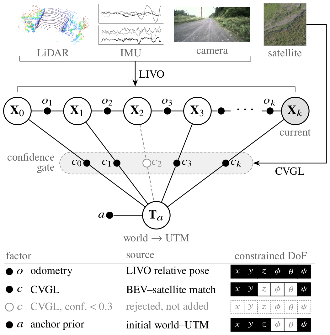
Autonomous robots increasingly operate across large-scale outdoor environments, where reliable navigation depends on accurate self-localization. Odometry provides this estimate but drifts over distance. Existing approaches to bound this drift are limited: loop closure needs revisits, GNSS fails in canyons, and prior maps are costly to build. We introduce CVGL-SLAM, which uses cross-view geo-localization (CVGL), matching ground observations to globally available satellite imagery, as an absolute constraint on odometry. To use noisy cross-view matches, it keeps only confident ones, and anchors the unconstrained vertical axis with gravity. CVGL-SLAM bounds odometry drift at large scale and outperforms odometry-only and loop-closure baselines.
Results on TartanDrive 2.0
Table 1. Absolute trajectory error (3D ATE RMSE, m) on TartanDrive 2.0, aligned on the first 100 m. Methods marked † use loop closure; ours does not. Best in bold.
| Method | 1253 | 1311 | 1342 | 1809 | pt2 |
|---|---|---|---|---|---|
| 4.4 km | 2.2 km | 1.7 km | 1.6 km | 1.6 km | |
| LTA-OM† | 1.91 | 324 | 2.33 | 1.44 | 9.13 |
| GLIM† | 3.00 | 17.3 | 5.71 | fail | 2.99 |
| Voxel-SLAM† | 3.86 | 8.92 | 3.25 | 2.78 | 4.19 |
| SE(3)-LIO | 2.74 | 14.3 | 2.99 | 1.40 | 6.37 |
| Ours | 2.60 | 1.52 | 1.59 | 1.39 | 1.86 |